
More on our work
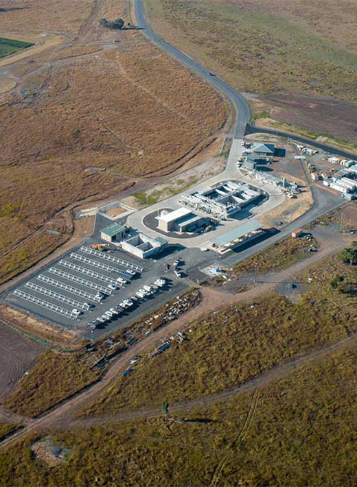
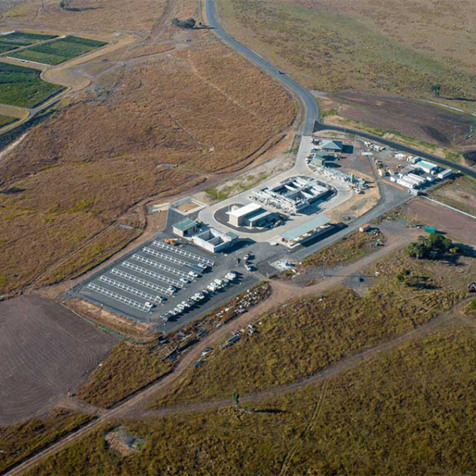
The Cedar Grove Environmental Centre provides various environmental and social benefits through its Wastewater Treatment Plant (WWTP), Landcare nursery and training centre, vegetation corridors, public amenities and community recreation reserve. The 204-hectare site is part of a public/private-sector partnership with Logan City Council in Queensland.
The site's sustainability initiatives include effluent filtration technology, constructed wetlands, catchment restoration, fish ladders, water recycling for agricultural irrigation, a solar farm for the facility's energy operations, biodiversity offset planting and wildlife habitat protection measures. The area is home to 120,000 native trees and shrubs, as well as over 20 bird species.
The project has won numerous industry awards, including the 2020 Australian Engineering Excellence Award for Queensland (Engineers Australia), the 2020 Award for Excellence, Innovation and Sustainability in Water (Institute of Public Works Engineering Australasia, Queensland) and the 2020 Infrastructure Project Innovation Award (Australian Water Association)
More on our work in Leicestershire
We’re working with Severn Trent and Leicestershire County Council on a catchment-wide solution to address flooding issues in Hinckley, Leicestershire.
By creating a fully integrated model that incorporates river, urban and 2D modelling, we were able to model the complex interaction between river flooding and sewerage network flooding. The model even includes built-in features like kerbs, hedges and reductions in storage capacity due to siltation and vegetation growth. LiDAR data was used to quantify how much detention pond storage had been reduced due to vegetation growth.
The model was used to examine flooding mechanisms across the catchment area and assess the viability of potential options and solutions. Ultimately, stakeholders will use the study help fund schemes that alleviate flooding that has regularly affected the local community.
More on our work in Sleepy Hollow
WSP is implementing a suite of green infrastructure and resilience strategies on the site of the former General Motors assembly plant in the Village of Sleepy Hollow, New York. Located next to the Hudson River, the site faces both river and coastal flooding threats. The urban renewal project will transform the site into a public amenity, while balancing several competing goals: maximizing recreational space; improving flood resistance and stormwater treatment capacity; accommodating and protecting the Department of Public Works facility within the flood zone; and maintaining the economic vitality of the residential community.
More on our work on the Kaituna river
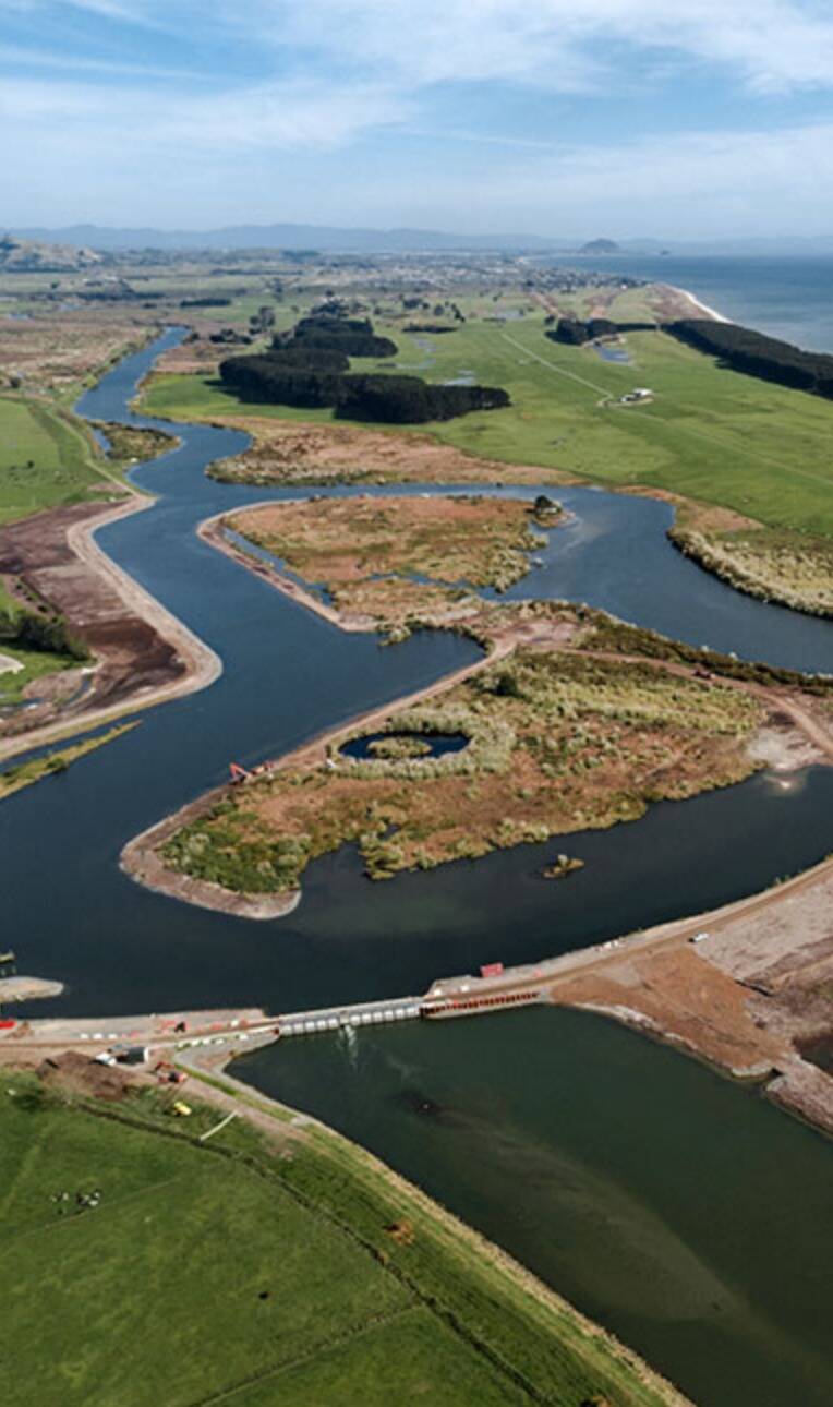
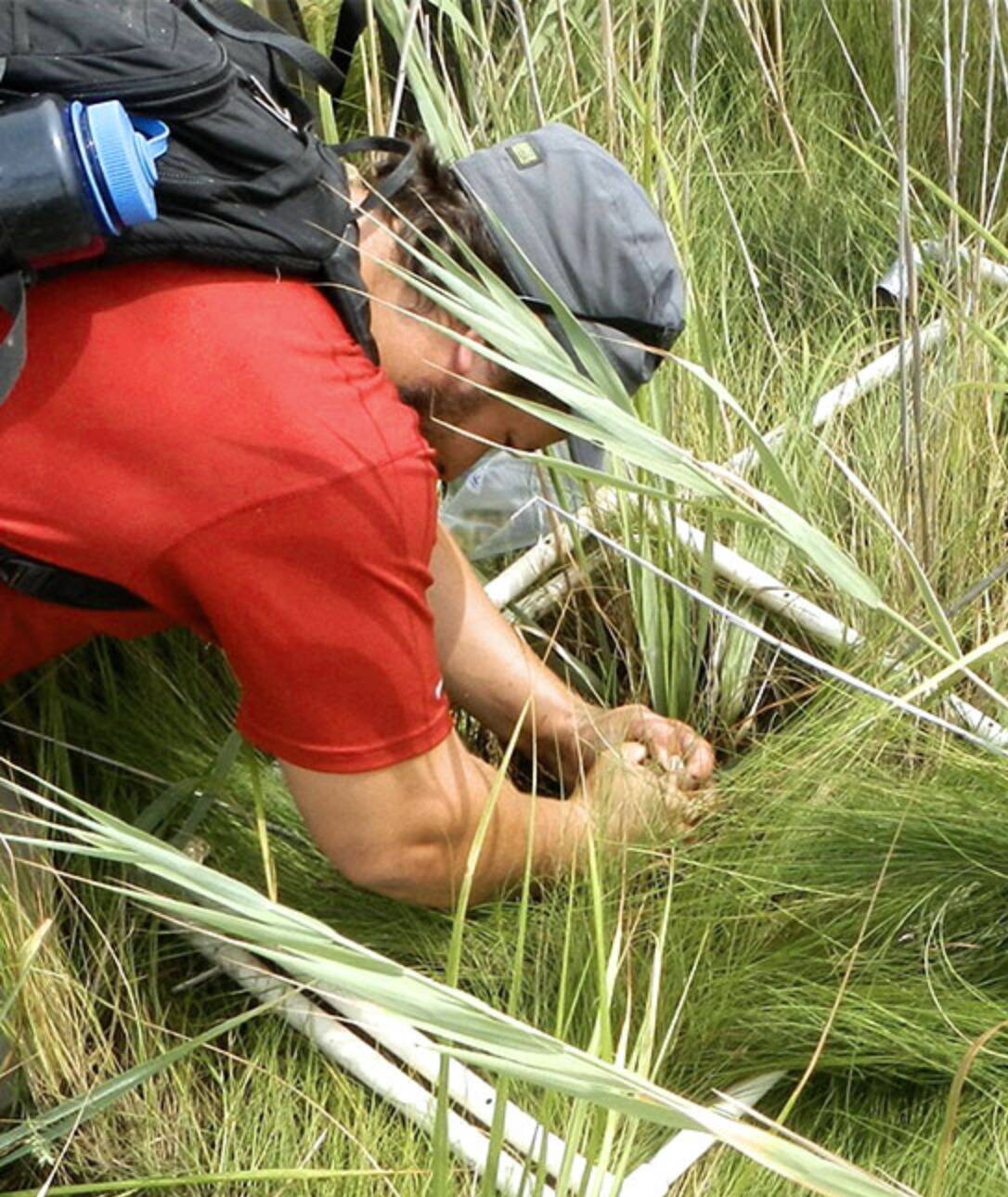
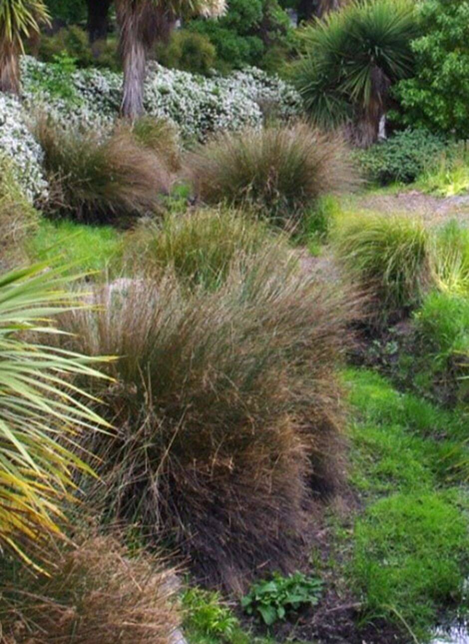
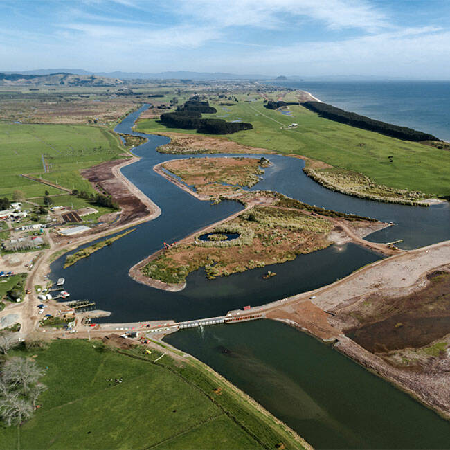
The Kaituna River Rediversion and Maketū Estuary Enhancement Project was established to address the long-standing negative effects caused when the river was diverted away from its natural outlet in 1956 so that the surrounding areas could be drained and farmed, leading to the loss of freshwater flows and subsequent collapse of the estuary’s ecological health.
The project, which aimed to recreate 20 hectares of wetland, was brought together the Bay of Plenty Regional Council, Western Bay of Plenty District Council, iwi and the community. The options proposed sought to maximise the ecological and cultural benefits (particularly wetlands and kaimoana) for the estuary.
WSP lead the planning process and supported stakeholder engagement and environmental and property services. Community engagement and project transparency were major priorities for the project, so significant efforts were made to communicate the highly technical aspects of the applications to the public. Collaboration with iwi to achieve cultural outcomes was critical to the success of the project.
This project demonstrates how true community collaboration can enable significant change and positive outcomes. Over time, these are expected to increase as the estuary and local community find better balance.

More on our work on flood risk management in Wales
By using the Flood Risk Modeller (FRM) tool, an innovative overland flow routing tool developed by WSP, Dŵr Cymru Welsh Water (DCWW) was able to better understand the flooding impacts caused by storms that are expected to become more frequent and severe due to climate change.
FRM is up to four times faster compared to similar tools on the market. It handles study area data at high resolution, making it more cost effective and efficient to use across large catchment areas. The tool has been used to generate more accurate predictions that DCWW needs to plan and prioritise flood management investments.
DCWW has used the FRM tool to map areas including Cardiff, Bridgend, Wrexham, Rhyl and others – covering one third of the population of Wales.
More on our work in New York City's wetlands
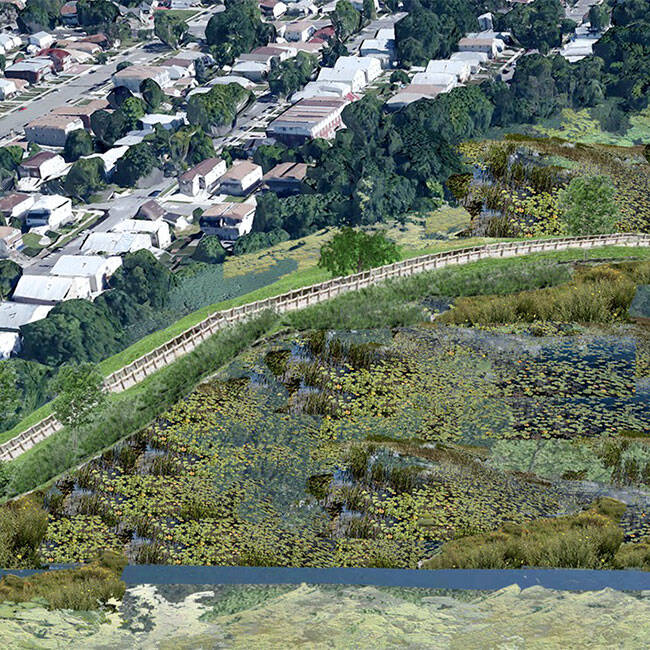
The Saw Mill Creek, located adjacent to an industrial park on Staten Island in New York City, has for years been threatened by illegal dumping, invasive vegetation and severe flooding. A strategy was needed to protect the 68-acre wetlands, while also fostering sustainable waterfront development.
WSP was chosen by the NYC Economic Development Corporation, in collaboration with other agencies, to provide restoration design for the city's first wetland mitigation bank. As part of the Mitigation and Restoration Strategies for Habitat and Ecological Sustainability Initiative, this project sought to improve water and sediment quality, increase biodiversity and improve storm surge protection.
WSP developed an ecological assessment methodology, conducted surveying and environmental testing, and performed threatened/endangered species analyses before providing restoration design plans for emergent wetlands, scrub-shrub wetlands, freshwater forested wetlands, open water channels/pools, mudflat habitat, and uplands.
More on our work in Christchurch’s urban waterways
WSP’s water resources and flood risk management team used water-led approaches to envision improvements for the social, cultural and environmental value of urban creek catchments in Christchurch.
The catchment area, located in a highly modified residential and industrial urban area, had poor water quality, flooding issues and low ecological value, presenting residents with limited social, cultural or environmental benefits.
The WSP team identified solutions that ensured the development was adaptive, resilient and regenerative. These were developed by back-casting from the Council’s 100-year vision by focusing on mixed-use development, inclusivity, and integration of open public spaces with nature. The long-term vision transforms highly impervious areas to enhance natural infiltration of the catchment and reduce flooding.
By reshaping the urban form, ecological dead zones between residential and industrial areas were minimised and connectivity throughout the catchment established.
More on our work in the Florida Everglades
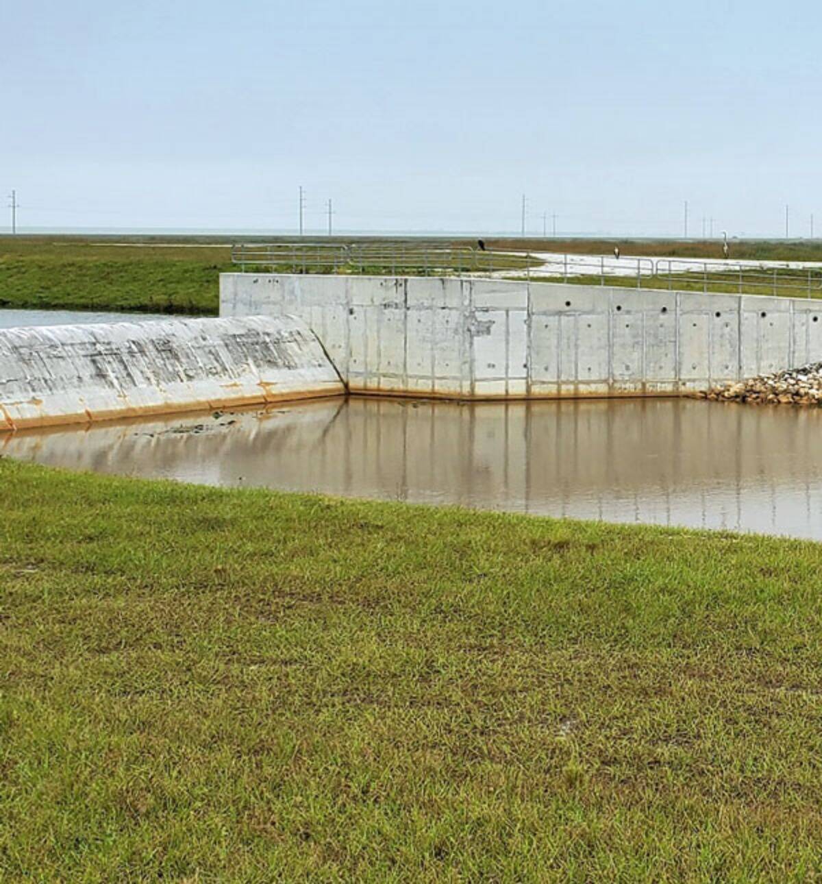
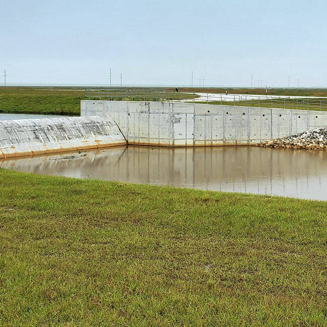
In the last several years, high levels of polluted stormwater runoff have affected the recreational interests and livelihoods of residents and businesses around the 10,000-acre C-44 Reservoir stormwater treatment area in Florida.
As part of the Comprehensive Everglades Restoration Plan (CERP) for improving the water resources of Central and Southern Florida, WSP provided management services for the construction of wetlands, canals, culverts, discharge structures, and embankments used for capturing and naturally treating local runoff from the basin, as well as controlling freshwater peak flow into estuaries.
This project aims to improve water quality by reducing the level of nutrients, pesticides, herbicides, and other pollutants being discharged into the estuary. This project also helps improve the resilience of the St. Lucy Estuary by controlling peak flows and protecting one of the most diverse marine’s environments in United States.
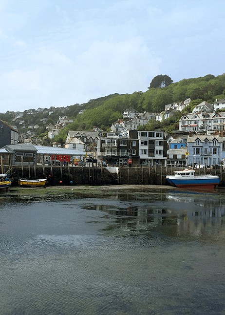
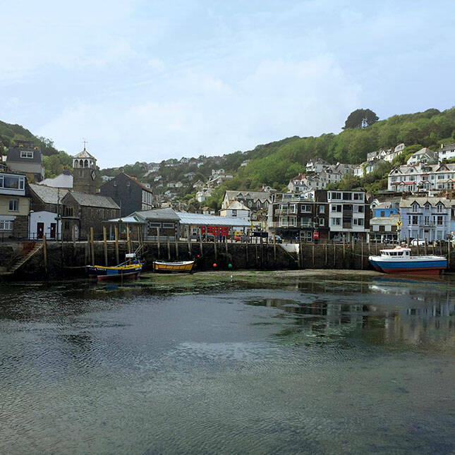
Cornwall’s picturesque and historic fishing harbour of Looe holds the dubious accolade of being the UK’s most flooded town. And, with sea levels expected to rise, flood risk is deterring investment and reducing opportunities for growth. As the flood risk escalates, the cost of repeat flooding over the next 100 years is estimated to be £160m.
WSP is working in partnership with Cornwall Council, Looe Harbour Commission and the Environment Agency on a flood protection scheme involving the construction of a new breakwater structure and tidal barrage that would protect the town for the next 100 years.
We are also engaging with the community to find ways for the flood defence strategies to be integrated into a wider regeneration context, providing the town with further ecological, recreation, and economic benefits.
By making the case for the flood defence project and winning the support and involvement of the local community, the project team aims to bring forward a scheme that could secure Looe’s long-term prosperity for generations to come.
Listen to Episode 1 of our Engineering Matters podcast to find out more
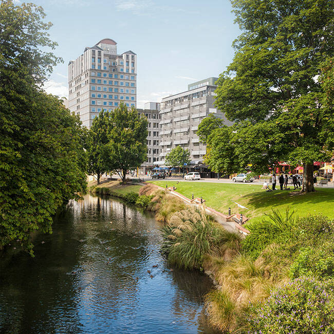
More on our work in Christchurch city
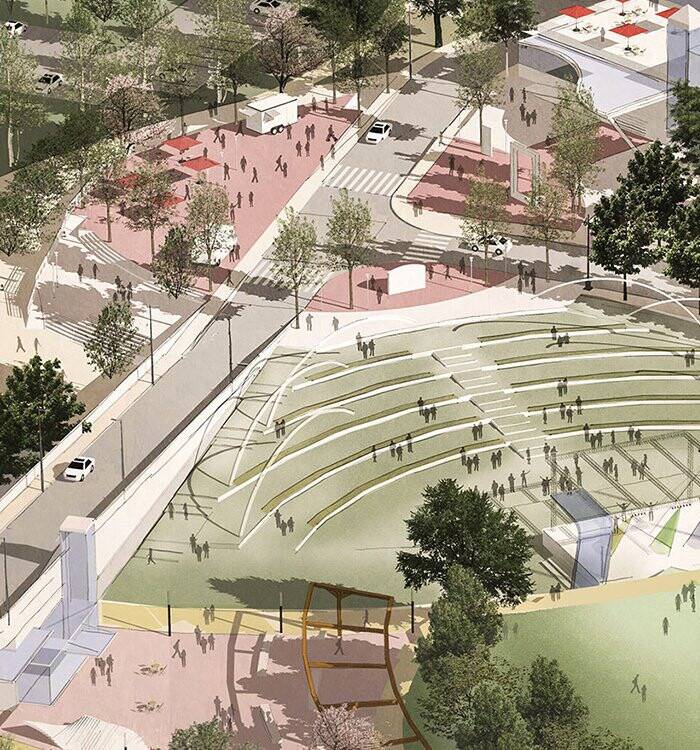
WSP is helping to recreate the heart of Christchurch, New Zealand, with a space that will promote recreation, tourism, business growth and central city living for residents and visitors alike.
As the first anchor project for the Canterbury Earthquake Recovery Authority (CERA), Te Papa Ōtākaro Avon River Park will change the shape of the city and act as a catalyst for Christchurch’s earthquake recovery.
The park will create accessible and sustainable spaces that can be enjoyed by people of all ages for recreation and relaxation. The design celebrates the natural, spiritual and ecological significance of the Avon River while improving accessibility and enhancing the river’s rich cultural heritage values.
We’ve brought our water expertise to clients all over the world, from estuary enhancements in New Zealand to water quality improvements in Florida to flood management in towns across the UK. Browse through the case studies below to find out more about some of the solutions we’ve provided to these projects, and more.

Discover this project
NEW ZEALAND
Breathing new life into Christchurch city

united kingdom
Making the case for Looe’s £74m flood defence project
Discover this project
UNITED STATES
Improving water resources management in the Florida Everglades
Discover this project
Discover this project
Prioritising the ‘mauri’ of Christchurch’s urban waterways
Discover this project

Restoring New York City’s first wetland mitigation bank

Discover this project
High-resolution flood risk modelling in Wales
Discover this project
NEW ZEALAND
Rediverting the Kaituna River to enhance the Maketu Estuary

Discover this project
UNITED STATES
Sleepy Hollow East Parcel Climate Resilient Redevelopment Plan

Discover this project
UNITED KINGDOM
Finding a catchment-wide solution to complex flooding in Leicestershire

Discover this project
QUEENSLAND, AUSTRALIA
Cedar Grove Environmental Centre
Discover this project
UNITED STATES
Integrated flood and emergency response planning for Long Island communities
Discover this project
UNITED KINGDOM
Finding a catchment-wide solution to complex flooding in Leicestershire

The Cedar Grove Environmental Centre provides various environmental and social benefits through its Wastewater Treatment Plant (WWTP), Landcare nursery and training centre, vegetation corridors, public amenities and community recreation reserve. The 204-hectare site is part of a public/private-sector partnership with Logan City Council in Queensland.
The site's sustainability initiatives include effluent filtration technology, constructed wetlands, catchment restoration, fish ladders, water recycling for agricultural irrigation, a solar farm for the facility's energy operations, biodiversity offset planting and wildlife habitat protection measures. The area is home to 120,000 native trees and shrubs, as well as over 20 bird species.
The project has won numerous industry awards, including the 2020 Australian Engineering Excellence Award for Queensland (Engineers Australia), the 2020 Award for Excellence, Innovation and Sustainability in Water (Institute of Public Works Engineering Australasia, Queensland) and the 2020 Infrastructure Project Innovation Award (Australian Water Association)
More on our work
More on our work in Leicestershire
We’re working with Severn Trent and Leicestershire County Council on a catchment-wide solution to address flooding issues in Hinckley, Leicestershire.
By creating a fully integrated model that incorporates river, urban and 2D modelling, we were able to model the complex interaction between river flooding and sewerage network flooding. The model even includes built-in features like kerbs, hedges and reductions in storage capacity due to siltation and vegetation growth. LiDAR data was used to quantify how much detention pond storage had been reduced due to vegetation growth.
The model was used to examine flooding mechanisms across the catchment area and assess the viability of potential options and solutions. Ultimately, stakeholders will use the study help fund schemes that alleviate flooding that has regularly affected the local community.
More on our work in Sleepy Hollow
WSP is implementing a suite of green infrastructure and resilience strategies on the site of the former General Motors assembly plant in the Village of Sleepy Hollow, New York. Located next to the Hudson River, the site faces both river and coastal flooding threats. The urban renewal project will transform the site into a public amenity, while balancing several competing goals: maximizing recreational space; improving flood resistance and stormwater treatment capacity; accommodating and protecting the Department of Public Works facility within the flood zone; and maintaining the economic vitality of the residential community.
More on our work on the Kaituna river
The Kaituna River Rediversion and Maketū Estuary Enhancement Project was established to address the long-standing negative effects caused when the river was diverted away from its natural outlet in 1956 so that the surrounding areas could be drained and farmed, leading to the loss of freshwater flows and subsequent collapse of the estuary’s ecological health.
The project, which aimed to recreate 20 hectares of wetland, was brought together the Bay of Plenty Regional Council, Western Bay of Plenty District Council, iwi and the community. The options proposed sought to maximise the ecological and cultural benefits (particularly wetlands and kaimoana) for the estuary.
WSP lead the planning process and supported stakeholder engagement and environmental and property services. Community engagement and project transparency were major priorities for the project, so significant efforts were made to communicate the highly technical aspects of the applications to the public. Collaboration with iwi to achieve cultural outcomes was critical to the success of the project.
This project demonstrates how true community collaboration can enable significant change and positive outcomes. Over time, these are expected to increase as the estuary and local community find better balance.
More on our work on flood risk management in Wales
By using the Flood Risk Modeller (FRM) tool, an innovative overland flow routing tool developed by WSP, Dŵr Cymru Welsh Water (DCWW) was able to better understand the flooding impacts caused by storms that are expected to become more frequent and severe due to climate change.
FRM is up to four times faster compared to similar tools on the market. It handles study area data at high resolution, making it more cost effective and efficient to use across large catchment areas. The tool has been used to generate more accurate predictions that DCWW needs to plan and prioritise flood management investments.
DCWW has used the FRM tool to map areas including Cardiff, Bridgend, Wrexham, Rhyl and others – covering one third of the population of Wales.
More on our work in New York City's wetlands
The Saw Mill Creek, located adjacent to an industrial park on Staten Island in New York City, has for years been threatened by illegal dumping, invasive vegetation and severe flooding. A strategy was needed to protect the 68-acre wetlands, while also fostering sustainable waterfront development.
WSP was chosen by the NYC Economic Development Corporation, in collaboration with other agencies, to provide restoration design for the city's first wetland mitigation bank. As part of the Mitigation and Restoration Strategies for Habitat and Ecological Sustainability Initiative, this project sought to improve water and sediment quality, increase biodiversity and improve storm surge protection.
WSP developed an ecological assessment methodology, conducted surveying and environmental testing, and performed threatened/endangered species analyses before providing restoration design plans for emergent wetlands, scrub-shrub wetlands, freshwater forested wetlands, open water channels/pools, mudflat habitat, and uplands.
More on our work in Christchurch’s urban waterways
WSP’s water resources and flood risk management team used water-led approaches to envision improvements for the social, cultural and environmental value of urban creek catchments in Christchurch.
The catchment area, located in a highly modified residential and industrial urban area, had poor water quality, flooding issues and low ecological value, presenting residents with limited social, cultural or environmental benefits.
The WSP team identified solutions that ensured the development was adaptive, resilient and regenerative. These were developed by back-casting from the Council’s 100-year vision by focusing on mixed-use development, inclusivity, and integration of open public spaces with nature. The long-term vision transforms highly impervious areas to enhance natural infiltration of the catchment and reduce flooding.
By reshaping the urban form, ecological dead zones between residential and industrial areas were minimised and connectivity throughout the catchment established.
More on our work in the Florida Everglades
In the last several years, high levels of polluted stormwater runoff have affected the recreational interests and livelihoods of residents and businesses around the 10,000-acre C-44 Reservoir stormwater treatment area in Florida.
As part of the Comprehensive Everglades Restoration Plan (CERP) for improving the water resources of Central and Southern Florida, WSP provided management services for the construction of wetlands, canals, culverts, discharge structures, and embankments used for capturing and naturally treating local runoff from the basin, as well as controlling freshwater peak flow into estuaries.
This project aims to improve water quality by reducing the level of nutrients, pesticides, herbicides, and other pollutants being discharged into the estuary. This project also helps improve the resilience of the St. Lucy Estuary by controlling peak flows and protecting one of the most diverse marine’s environments in United States.
Listen to Episode 1 of our Engineering Matters podcast to find out more
Cornwall’s picturesque and historic fishing harbour of Looe holds the dubious accolade of being the UK’s most flooded town. And, with sea levels expected to rise, flood risk is deterring investment and reducing opportunities for growth. As the flood risk escalates, the cost of repeat flooding over the next 100 years is estimated to be £160m.
WSP is working in partnership with Cornwall Council, Looe Harbour Commission and the Environment Agency on a flood protection scheme involving the construction of a new breakwater structure and tidal barrage that would protect the town for the next 100 years.
We are also engaging with the community to find ways for the flood defence strategies to be integrated into a wider regeneration context, providing the town with further ecological, recreation, and economic benefits.
By making the case for the flood defence project and winning the support and involvement of the local community, the project team aims to bring forward a scheme that could secure Looe’s long-term prosperity for generations to come.
WSP is helping to recreate the heart of Christchurch, New Zealand, with a space that will promote recreation, tourism, business growth and central city living for residents and visitors alike.
As the first anchor project for the Canterbury Earthquake Recovery Authority (CERA), Te Papa Ōtākaro Avon River Park will change the shape of the city and act as a catalyst for Christchurch’s earthquake recovery.
The park will create accessible and sustainable spaces that can be enjoyed by people of all ages for recreation and relaxation. The design celebrates the natural, spiritual and ecological significance of the Avon River while improving accessibility and enhancing the river’s rich cultural heritage values.
More on our work in Christchurch city
Cedar Grove Environmental Centre
QUEENSLAND, AUSTRALIA
Discover this project
UNITED KINGDOM
Finding a catchment-wide solution to complex flooding in Leicestershire
Discover this project

UNITED STATES
Sleepy Hollow East Parcel Climate Resilient Redevelopment Plan
Discover this project

NEW ZEALAND
Rediverting the Kaituna River to enhance the Maketu Estuary
Discover this project
Discover this project

High-resolution flood risk modelling in Wales
Restoring New York City’s first wetland mitigation bank
Discover this project
Prioritising the ‘mauri’ of Christchurch’s urban waterways
Discover this project

UNITED STATES
Improving water resources management in the Florida Everglades
Discover this project
Discover this project
united kingdom
Making the case for Looe’s £74m flood defence project

Discover this project
NEW ZEALAND
Breathing new life into Christchurch city
We’ve brought our water expertise to clients all over the world, from estuary enhancements in New Zealand to water quality improvements in Florida to flood management in towns across the UK. Browse through the case studies below to find out more about some of the solutions we’ve provided to these projects, and more.